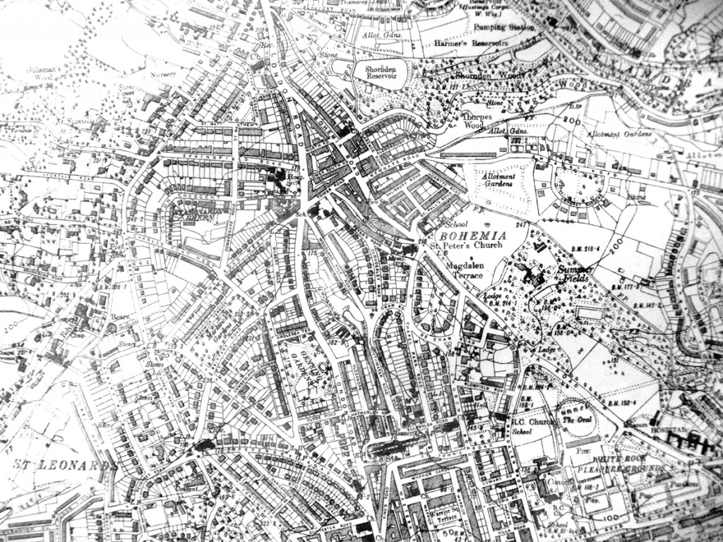
Map of Bohemia, 1938
A 1938 map of Bohemia showing several items of interest including:
Magdalen Terrace – in Bohemia Road, between Chapel Park Road and Church Road, where Lidl supermarket and Shell Garage now stand.
Allotment Gardens – in Amherst Road, now St Paul’s School and the Pashley Gardens development.
St Paul’s School – at the corner of St Paul’s Road and Bohemia Road, now the YMCA youth centre.
Buchanan Hospital – at the junction of Springfield Road and London Road, now Buchanan Gardens.
South Lodge – marked ‘Lodge’ in Bohemia Road, opposite Magdalen Road, now replaced by two buildings, also called ‘South Lodge’.
Bohemia House – shown in Summerfields Wood, now demolished and replaced by the Register Office and other buildings.
Bohemia Walled Garden – shown in Summerfields Wood, now being actively used by the Bohemia Walled Garden Association.
Fire Station – on corner of Bohemia Road and Salisbury Road, now Merrick House.
North Lodge – marked ‘Lodge’ on the east side of Bohemia Road, between De Cham Road and Church Road, now replaced by Bohemia Fire Station.
This map was originally published by Cook, Hammond and Kell Ltd of 47 and 48 Tothill Street, Westminster and dated 31 December 1938. Reproduced by kind permission of local solicitors, Menneer Shuttleworth, in whose St Leonards’ office the original copy hangs.
Leave a Response
You must be logged in to post a comment.


