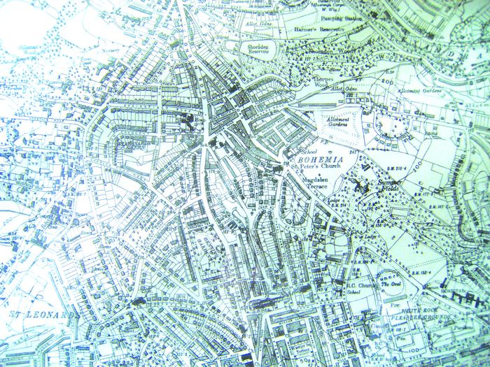
Pre-war Bohemia map shows how we’ve changed
This map of Bohemia, drawn seventy short years ago, superficially looks much like Bohemia today. But a closer inspection reveals many differences. The row of fine Victorian houses which made up Magdalen Terrace is now Lidl supermarket and the Shell service station. The ‘Allotment Gardens’ are replaced by St Paul’s School and the new Park Lane housing development. The school shown at the corner of St Paul’s Road and Bohemia Road is now the YMCA. The ‘Hosp’ shown in London Road, i.e. the Buchanan Hospital, is now of course Buchanan Gardens. Summerfields House and the two lodges are gone, and the Oval really was an oval. The image above is actually a photograph of part of a map hanging in the offices of local solicitors Menneer Shuttleworth, and is reproduced with their kind permission. The original map was published in 1938 by Cook, Hammond & Kell, Ltd, 47 & 48 Tothill Street, Westminster.
Leave a Response
You must be logged in to post a comment.


